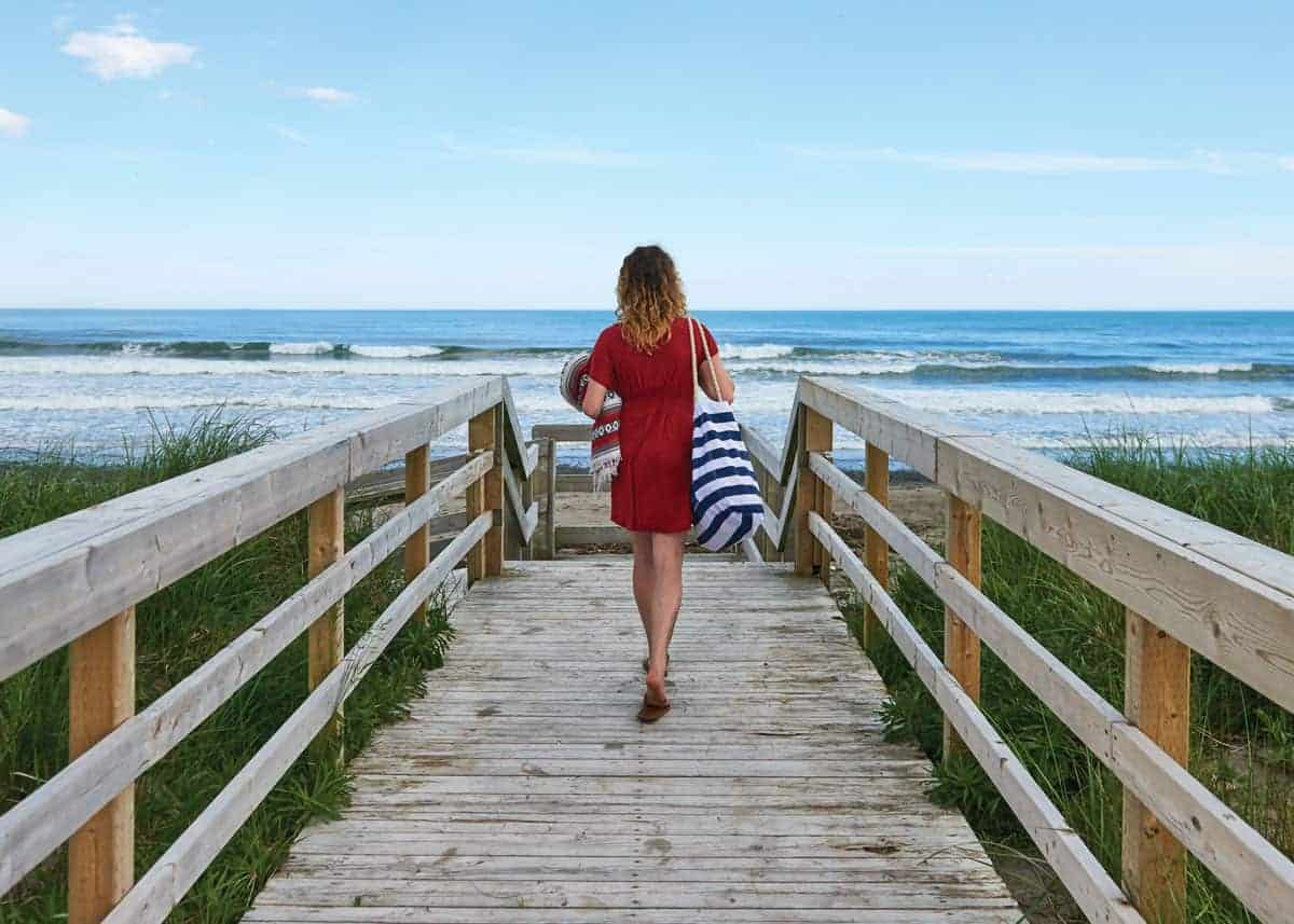
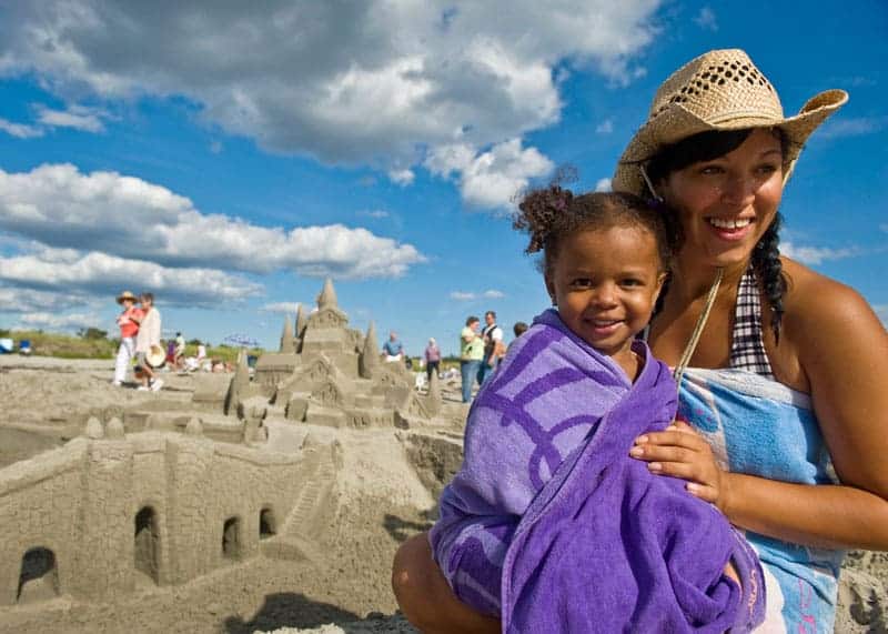
Nova Scotia Beaches: Guide to 41 Best Beaches in Nova Scotia
Looking for the best beaches in Nova Scotia? Here’s the complete guide to Nova Scotia beaches – including the longest, warmest and best surfing beaches.
Despite its northern location, Nova Scotia is known for having some of the warmest waters north of the Carolinas. And with 7500 km of coastline, there are a lot of beaches.
In Nova Scotia, it’s impossible to be more than 67 km (42 mi) from the ocean.
In this post, I’ll share the best beaches in Nova Scotia. Each of the 41 beaches is organized by region (South Shore, Halifax, Eastern Shore, Cape Breton, Northumberland Shore, Annapolis Valley /Bay of Fundy, and Yarmouth / Acadian Shore).
For each beach, I include a photo/video, map, and overview including facilities, address, and more.
But first, here are the longest, warmest and best surfing beaching in Nova Scotia.
Nova Scotia Beaches: Longest, Warmest, Best for Surfing
Note: This article is still growing. Want to suggest a beach or an update? Leave me a comment at the end of the page.
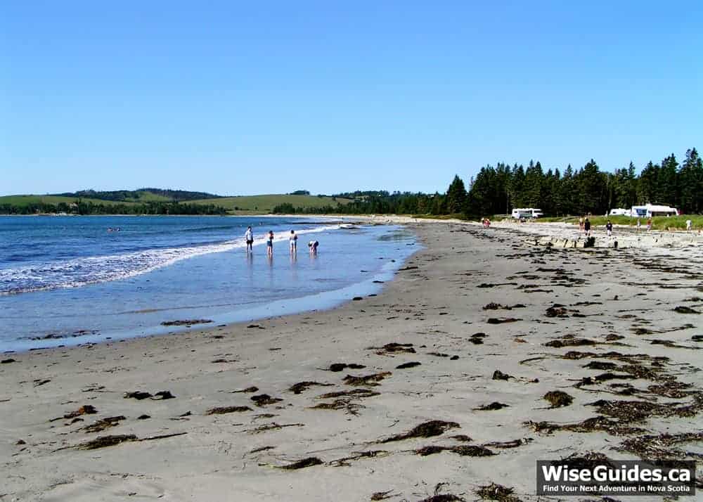
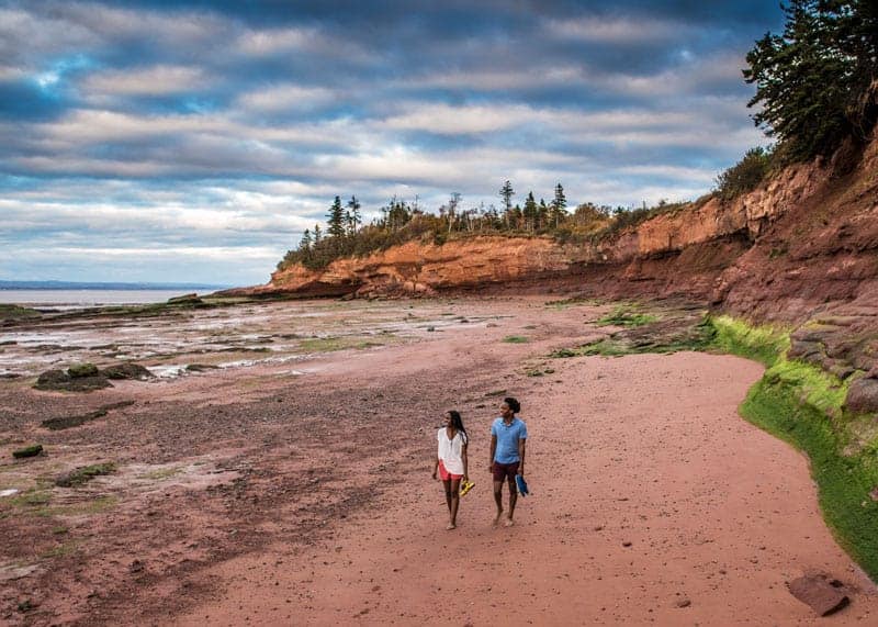
- Longest beach in Nova Scotia: The longest sandy beach is Martinique Beach at 3.4 km. Martinique Beach is located on the Eastern Shore, south of Musquodoboit Harbour.
- Warmest beach in Nova Scotia: While this can change, depending on the day, you should definitely check out the beaches on the North Shore, including beaches on the west coast of Cape Breton: Melmerby Beach (Northumberland Strait), Port Hood (Cape Breton) and Queensland (South Shore, near Halifax).
- Best surfing beach in Nova Scotia: Based on popularity, Lawrencetown Beach wins hands down. But if you’re looking for another option, you might consider Conrad’s Beach – located just a few minutes before Lawrencetown Beach.
41 of Nova Scotia’s Best Beaches
Here’s the full list of Nova Scotia beaches.
- South Shore Beaches (See all 10 beaches)
- Halifax Beaches (See all 7 beaches)
- Eastern Shore (See all 3 beaches)
- Cape Breton Beaches (See all 7 beaches)
- Northumberland Shore Beaches (See all 5 beaches)
- Bay of Fundy Beaches (See all 3 beaches)
- Annapolis Valley Beaches (See all 4 beaches)
- Yarmouth and Acadian Shore (See all 2 beaches)
South Shore Beaches
- Carters Beach
- Sandhills Beach
- Queensland Beach
- Rissers Beach
- Crescent Beach
- White Point Beach
- Kejimkujik National Park Seaside
- Bayswater Beach
- Hirtle’s Beach
- Cleveland Beach
Carters Beach, Port Mouton
Overview: Carters Beach is located about 20 km south of Liverpool, on Nova Scotia’s South Shore. It is actually made up of three crescent beaches of soft, white sand.
The ocean floor is full of sand dollars and there are often many on the beach.
Carter’s Beach is one of the most beautiful beaches in Nova Scotia. It’s the closest to a tropical-style, white-sand beach that you’ll find here in Nova Scotia.
But all is not perfect at Carter’s Beach. The parking is awful, there are no facilities and the water can be icy cold. And while the water warms up by August, it is still colder than many of the other beaches on the South Shore.
Carter’s Beach used to be a bit of a local secret. I remember going there as a kid with my grandparents (more than 20 years ago) and there were just a handful of people there.
This past summer there were hundreds of people at a time. As with all of these beaches, you can avoid much of the crowd by visiting during the week and away from holidays.
Looking for beaches will some smaller crowds? Read on.
- Facilities: Virtually none. We heard that there was a Porta-Potty installed in August 2016. There are a few garbage cans. And parking for 6-8 cars. Everyone else must park on the narrow road.
- Lifeguard: No
- Camping: No
- County: Queens
- Region: South Shore (Lighthouse Route)
- Address: Carters Beach Rd, Port Mouton, NS B0T 1T0
- Nearest town: Liverpool (about 20 km).
- Directions to Carters Beach: Travel Highway #3 (Lighthouse Route) west towards Shelburne/Yarmouth. In the village of Port Mouton, you’ll turn left onto Central Port Mouton Road. You’ll travel 2.5 km and take Carters Beach Road to the left. This road is just under 1 km and the parking is at the end.
Travel note: Update (March 5, 2017) A reader let us know that Google Maps are correct now – showing the new bypass that makes the old Hwy 103 become Hwy 3.
Sandhills Beach, Barrington
Overview: Sandhills Beach is a 2.5 km white-sand beach in Barrington. The water is warm because it is heated by the sand flats as the tide comes in. This makes it great for swimming and snorkeling.
The beach is located in a provincial park and is good for beach-combing, deep-sea clamming, kite-flying, and picnics. Sandhills Beach is popular for bird-watching.
- Facilities: Change rooms, washrooms, outdoor showers, and water taps.
- Lifeguard: No
- Camping: No
- County: Shelburne
- Region: South Shore (Lighthouse Route)
- Address: 28 Sand Hills Beach Road, Villagedale, Nova Scotia
- Nearest town: Barrington (6 km)
- Directions: From Barrington, travel south on Trunk 309. After 4.4 km turn right. Park is at the end of the road.
Queensland Beach, Hubbards
Overview: Queensland Beach is especially family-friendly – with calm, warm water. Because of its sheltered location on St. Margarets Bay, Queensland beach is especially safe – there are no rips or currents. And there is very little surf.
This is one of Nova Scotia’s warmest beaches.
Queensland Beach is located in Hubbards, about 35 km from Halifax (and 50 km from Bridgewater). It has been supervised by the Nova Scotia Lifeguard Service since 1973.
- Facilities: Change rooms, outhouses, and a 300m beach with gentle waves.
- Lifeguard: Yes. During the months of July and August from 10AM to 6PM, unless otherwise noted.
- Camping: No
- County: Halifax
- Region: South Shore (Lighthouse Route)
- Address: Hwy 3, Halifax, B0J 1T0.
- Nearest town: Hubbards (about 2 km).
- Directions: From Halifax, travel west on Highway #103 (Lighthouse Route) and take the exit for Hubbards/Queensland. You’ll go left off the exit onto Mill Lake Road. Then take another left onto Highway #3 and travel into Hubbards (4.9km).
Rissers Beach, Petite Riviere
Overview: Rissers Beach is a 1-kilometer, white sand beach located 25 km south of Bridgewater. Because it is managed by Nova Scotia Provincial Parks, it’s clean and well maintained. There is a huge parking lot with a walking trail (under the road) to the beach.
Rissers Beach is a very safe beach. Its location in Green Bay keeps the water relatively calm. Surf seldom exceeds 1 meter and there are no drop-offs.
Water temperature can change dramatically from one day to the next.
Dogs are permitted if they are on a leash.
- Facilities: Picnic areas and a large supervised beach. Bathrooms, change rooms with showers, and a canteen. There is a boardwalk along an inland marsh.
- Lifeguard: Yes. During the months of July and August from 10AM to 6PM, unless otherwise noted.
- Camping: Yes – 93 sites including 19 serviced sites (electrical and water). The campground is divided into two sections. The beachfront camping (Little Rissers) has outhouses only and no showers. The sheltered camping area (North Rissers) is well equipped with shower and bathroom facilities.
- County: Lunenburg
- Region: South Shore (Lighthouse Route)
- Address: 5463 Highway #331, Petite Rivière
- Nearest town: The community of Petite Riviere has a couple of stores (1.5 km west). The nearest town of any size is Bridgewater (25 km north).
- Directions: From Bridgewater, take the 331 W along the LaHave River. Travel approximately 25 km. There will be signs clearly marking the beach and campground. You’ll turn right (away from the water) for both camper registration and public beach parking (free).
Crescent Beach, Petite Riviere
Overview: Crescent Beach is a 2 km long, white sand beach. It is located less than 1 km away from Rissers Beach. The beach actually forms a causeway that connects Georges Island (the closest of the Lahave Islands) to the mainland.
It is windy and is great for kite flying. Windsurfers and kite buggies (see video below) are also seen there frequently. The beach is open to drive on and the sand is hard-packed. Although you should be careful.
Crescent Beach is located in Lunenburg County, south of Bridgewater. This is not to be confused with the similarly named Crystal Crescent Beach located up the shore in Halifax county. See more about Crystal Crescent Beach below.
- Facilities: There are a couple of Porta-Potty units and some garbage cans. The beach stays generally clean and is great for walking.
- Lifeguard: No.
- Camping: No.
- County: Lunenburg
- Region: South Shore (Lighthouse Route)
- Address: Crescent Beach Road, Petite Rivière
- Nearest town: The community of Petite Riviere has a couple of stores (1.5 km west). The nearest town of any size is Bridgewater (25 km north).
- Directions: From Bridgewater, take the 331 W along the LaHave River. Travel approximately 24 km. There will be signs clearly marking the beach. You’ll turn left onto Crescent Beach Road.
White Point Beach, White Point
Overview: White Point Beach is one of the most famous beaches in Nova Scotia. It’s located south of the town of Liverpool on the South Shore. It is 1 km of fine white sand.
This beach is unique because it is private. A $ 10-day pass gives you access to the beach and related facilities and services.
The beach is owned and operated by White Point Beach Lodge – a luxury accommodation, providing guest rooms and beach cottages. The history of the lodge goes back to 1928.
For more information about lodging, check out: White Point Beach Lodge
- Facilities: With your day pass ($10), you get access to all their recreation facilities, programs, services, and Wi-Fi.
- Lifeguard: Not listed
- Camping: No
- County: Queens
- Region: Lighthouse Route (South Shore)
- Address: 75 White Point Beach Resort Rd, White Point, Queens County, Nova Scotia, B0T 1G0
- Nearest town: Liverpool (10 km)
- Directions: Take Highway 103 from Halifax. Take Exit 20A. At the intersection of the highway connector and Route 3, turn right onto Route 3. Follow Route 3 (White Point Road) west to White Point Beach Lodge.
Kejimkujik National Park Seaside, Port Joli
Overview: Kejimkujik Seaside is a large reserve of 22 square km of coastline. The park and beaches are on the same peninsula as Carter’s Beach (see above). This park is managed by Parks Canada and admission is free.
Kejimkujik Seaside is known locally as Keji Adjunct or the Seaside Adjunct. The Seaside Adjunct is part of a larger park, Kejimkujik National Park.
There are two trails:
- Harbour Rock Trail (5.2 km return)
- Port Joli Head Trail (8.7 km return)
You can see seals and many varieties of shorebirds. The endangered piping plovers nest here.
Read more about Kejimkujik Seaside.
- Facilities: There are bathroom facilities at the start of the hike and outhouses near the beach. There are also benches, interpretation exhibits, and telescopes (for viewing wildlife).
- Lifeguard: No
- Camping: No
- County: Queens
- Region: Lighthouse Route (South Shore)
- Address: 1188 St Catherines River Rd, Port Joli, NS B0T 1S0
- Nearest town: Liverpool (30 km)
- Directions: Take Highway 103 from Halifax. Take Exit 22. Continuing towards Port Joli and turning onto St. Catherine’s River Road while following the Parks Canada signs.
Bayswater Beach, Hubbards
Overview: Bayswater Beach is a white sand beach and picnic area. It also has outdoor barbecue grills, change rooms, and toilets. This is a supervised beach during the months of July and August.
The beach is safe with no rips or currents. Because of the slope of the beach, there can be occasional “dumping” waves that occur close to shore.
- Facilities: Change rooms, bathrooms, picnic area, and a 500m beach.
- Lifeguard: Yes. During the months of July and August from 10AM to 6PM, unless otherwise noted.
- Camping: No
- County: Lunenburg
- Region: South Shore (Lighthouse Route)
- Address: 4015 Hwy 329, Bayswater.
- Nearest town: Hubbards (about 20 km north).
- Directions: From Hubbards, travel south on the 329. It is located at the end of the peninsula, between the communities of Aspotogan and Blandford.
Hirtle’s Beach, Kingsburg
Overview: Hirtle’s Beach is a 3 km long, crescent-shaped beach on Hartling Bay. Located roughly 18 km south of the town of Lunenburg, Hirtle’s Beach is located at the end of a usually shaped peninsula.
At the west end of the beach, you can take a hike of 3.5 km (return) to Gaff Point. Gaff Point Trail is an easy and scenic hike. Allow roughly 2 hours for this hike.
Because of its location, there are fewer crowds than on many of the other large beaches.
- Facilities: A basic picnic area and boardwalk. Washrooms.
- Lifeguard: No
- Camping: No
- County: Lunenburg
- Region: South Shore (Lighthouse Route)
- Address: Hirtle Beach Rd, Kingsburg, NS B0J 2X0
- Nearest town: Lunenburg (about 18 km north)
- Directions: From Lunenburg, take the 332 West towards Riverport for 12 km. At Rose Bay, turn left onto Kingsburg Road. After 4 km, turn left onto Hirtle Beach Road and drive to the end.
Cleveland Beach, Black Point
Overview: Cleveland Beach Provincial Park is just a few kilometers east of the larger, and better-known Queensland Beach. There is ample parking and a couple of outhouses.
- Facilities: Outhouses
- Lifeguard: No
- Camping: No
- County: Halifax
- Region: South Shore (Lighthouse Route)
- Address: 8880 St Margarets Bay Rd, Black Point, NS B0J 1B0
- Nearest town: Hubbards (about 6 km).
- Directions: From Halifax, travel west on Highway #103 (Lighthouse Route) and take the exit for Hubbards/Queensland. You’ll go left off the exit onto Mill Lake Road. Then take another left onto Highway #3 (St. Margarets Bay Road) and travel through Hubbards, past Queensland Beach. Cleveland Beach will be on your right.
Halifax Beaches
- Crystal Crescent Beach
- McNabs Island
- Rainbow Haven Beach
- Lawrencetown Beach
- Conrad’s Beach
- MacCormacks Beach
- Chocolate Lake
Crystal Crescent Beach, Sambro
Overview: Crystal Crescent Beach is located directly south of Halifax (25 km). It is managed by Provincial Parks and comes equipped with outhouses, boardwalks, and two large parking lots.
The Crystal Crescent Beach Provincial Park has 3 crescent-shaped white-sand beaches.
It should be noted that the 3rd (and furthest beach) has been used as a nude/naturalist beach.
From the parking lot, you can hike Pennant Point – a 20 km return hike ideal for bird watching.
- Facilities: Outhouses at the first two beaches, two parking lots, boardwalks to the first two beaches.
- Lifeguard: No
- Camping: No
- County: Halifax Regional Municipality
- Region: Halifax Dartmouth
- Address: Crystal Crescent Beach Road, Sambro, Halifax Metro, B3V 1L8
- Nearest town: Sambro (4 km)
- Directions: From Halifax, travel south on Northwest Arm Drive (Hwy 3). Turn left onto Old Sambro Road (Hwy 306). In Sambro, turn right (at Mishoo’s Take Out) onto West Pennant Road. After 1.3 km, turn left onto East Pennant Road. Then take Sambro Creek Road (2nd left). Your next left will be Crystal Crescent Beach Road.
Maugers Beach, McNabs Island
Overview: Maugers Beach is located on the west side of McNabs Island, which sits at the entrance of Halifax Harbour. McNabs Island forms part of the McNabs and Lawlor Provincial Park.
This island is just a short boat ride from Halifax or Eastern Passage.
Read more about the island: Friends of McNabs Island Society
There are a number of beaches on the Island. Most notable is Maugers Beach, located on the southern end of McNabs Cove.
To the west of Maugers Beach is the Maugers Beach Lighthouse.
- Facilities: Outhouses are located at 6 locations on the island – a few within walking distance of Maugers Beach.
- Lifeguard: No
- Camping: With the approval of the NS Department of Natural Resources (Waverley 902-861-2560) you can camp on the island. Campfires are not permitted – only camp stoves. There is no drinking water available on the island.
- County: Halifax Regional Municipality
- Region: Halifax Dartmouth
- Address: McNabs Island, Halifax Harbour, Halifax Regional Municipality.
- Nearest town: Halifax or Eastern Passage
- Directions: A short boat ride from either Halifax or Eastern Passage. Trips take 20-30 minutes (Halifax) or 10 minutes (Eastern Passage). Cost ranges from $15-20 per person.
There are a number of charters and water taxis that run daily. Here’s more about getting to McNabs Island.
Rainbow Haven Beach, Cow Bay
Overview: Rainbow Haven is a very popular beach for families. The beach is just 25 minutes from Dartmouth and is operated by the Nova Scotia Provincial Parks.
The 1 km beach is fine white sand and the beach is quite wide. Known for cold water and great kite flying.
The beach at Rainbow Haven has a tidal channel that creates very strong currents. Lifeguards regularly patrol the beach to discourage swimmers from unsafe areas, including the channel. Hazard signs mark unsafe areas.
- Facilities: Change houses, cold outdoor showers, washrooms, and large parking lots. Wheelchair access to the beach via boardwalks.
- Lifeguard: Yes. During the months of July and August from 10AM to 6PM, unless otherwise noted.
- Camping: No
- County: Halifax
- Region: Marine Drive (Eastern Shore)
- Address: 2249 Cow Bay Rd, Cow Bay, Eastern Shore, Halifax County
- Nearest town: Cole Harbour (7 km)
- Directions: From Dartmouth, take Hwy 207 (Portland Street) east. After crossing Dorothea Drive / Caldwell Road intersection, the road name becomes Cole Harbour Road. Take the #322 right (Marine Drive) south. Turn left at the Cow Bay Road intersection to enter Rainbow Haven Beach Park.
Lawrencetown Beach: Surfing near Halifax
Overview: Lawrencetown Beach is a 1.5 km surfers beach just 30 minutes from Dartmouth.
According to the Nova Scotia Lifeguard Service, lifeguards regularly walk patrols to keep swimmers away from rips or high surf areas like the reef.
Don’t know how to surf? No problem. You can get surf and SUP lessons (and rentals) from Kannon Beach, Happy Dudes, and East Coast Surf School.
- Facilities: Change houses, cold showers, washrooms, and large parking lots.
- Lifeguard: Yes. During the months of July and August from 10AM to 6PM, unless otherwise noted.
- Camping: No
- County: Halifax
- Region: Marine Drive (Eastern Shore)
- Address: 4348 Lawrencetown Road, Lawrencetown, Halifax County
- Nearest town: Cole Harbour (12 km)
- Directions: From Dartmouth, take Hwy 207 (Portland Street) east. After crossing Dorothea Drive / Caldwell Road intersection, the road name becomes Cole Harbour Road. After passing Cole Harbour, the road name becomes Lawrencetown Road. Follow this road to Lawrencetown Beach Provincial Park. The beach is on the right.
Conrad’s Beach, West Lawrencetown
Overview: Conrad’s Beach is a 1.3 km long white-sand beach, located minutes before Lawrencetown Beach (see above). The lack of facilities keeps the crowds going to other local beaches, like Rainbow Haven Beach (to the west) and Lawrencetown Beach (to the east).
While Conrad’s Beach comes very well-reviewed, it is still somewhat of a local secret. It’s very popular with locals and the eight-spot parking lot fills quickly.
There is lots of space on the roadside, but be sure to stay on the east side of the road.
Conrad’s Beach is known as one of the best spots on the east coast for standup paddleboarding and wind/kite surfing.
Watch for signs identifying Piping Plover Breeding Areas. Piping Plovers are small tan-colored birds that run along the beach. Conrad’s Beach is a protected breeding ground for these endangered birds and they are protected by the Piping Plover Guardian Program. Please remain on the boardwalk and watch for the signs.
- Facilities: Conrad’s Beach has no facilities (washrooms, change rooms, or food stands). The parking lot is small.
- Lifeguard: No
- Camping: No
- County: Halifax
- Region: Marine Drive (Eastern Shore)
- Address: Conrad Road, West Lawrencetown, Halifax County, NS B2Z 1S5
- Nearest town: Cole Harbour (9 km)
- Directions: From Dartmouth, take Hwy 207 (Portland Street) east. After crossing Dorothea Drive / Caldwell Road intersection, the road name becomes Cole Harbour Road. After passing Cole Harbour, the road name becomes Lawrencetown Road. Follow this road to Conrad Road across from the Lawrencetown Community Center and turn right. Follow the road to the end.
MacCormack’s Beach, Eastern Passage
Overview: MacCormack’s Beach Provincial Park is located in the community of Eastern Passage (Halifax Harbour). It is located south of Fisherman’s Cove, a restored 200-year-old fishing village. From here, you can get a boat charter to either Lawlor or McNab’s Islands.
The beach is popular for walking and clam digging. It is not safe for swimming near the point due to the dangerous currents and undertow in the water that runs between Lawlor Island and the mainland. The 1.2 km boardwalk that runs parallel to the beach is wheelchair accessible (1 m wide).
McCormack’s or MacCormacks Beach? (Mc or Mac?) As with many names in Nova Scotia, there is a bit of confusion about how to spell (and thus pronounce) the name of this beach. It seems that only the Province of Nova Scotia and TripAdvisor spell it Mc. Just about everywhere else you’ll see it spelled MacCormack (Mac).
On Instagram, MacCormick’s Beach Provincial Park is a place and #maccormacksbeach has more than double the posts than its slightly shorter counterpart. So if hashtags were votes, MacCormack’s Beach wins.
- Facilities: A few picnic areas and a walking trail. More facilities at nearby Fisherman’s Cove.
- Lifeguard: No. Swimming is not permitted near the point – because of hazardous currents.
- Camping: No
- County: Halifax Regional Municipality
- Region: Halifax Dartmouth
- Address: 1641 Shore Rd, Eastern Passage, NS
- Nearest town: Eastern Passage
- Directions: Take Pleasant Street south (changing into Main Street) and follow to Fisherman’s Cove. MacCormack’s Beach is on the right.
Here is another beach in Halifax to consider:
- Chocolate Lake Beach (freshwater lake): Located just off Herring Cove Road and minutes from downtown Halifax.
Eastern Shore Beaches
- Taylor Head Beach
- Martinique Beach
- Clam Harbour Beach
Taylor Head Beach, Spry Bay
Overview: Taylor Head Provincial Park is located about 100 km east of Halifax/Dartmouth on a 6 km finger-like peninsula.
The beach has basic services and 4 large parking lots. The provincial park has 12.5 km of interconnected trails with a number of scenic look-offs.
- Facilities: At the main beach, in Psyche Cove, there are outhouses, change rooms, picnic areas, and 4 large parking lots. There are 4 walking trails on the peninsula.
- Lifeguard: No
- Camping: No
- County: Halifax Regional Municipality
- Region: Marine Drive (Eastern Shore)
- Address: 20140 Hwy 7, Spry Bay, Eastern Shore
- Nearest town: Sheet Harbour (11 km)
- Directions: Travel east on Hwy #7 (98 km) from Dartmouth.
Martinique Beach, Musquodoboit Harbour
Overview: At 3.4 km in length, Martinique Beach is Nova Scotia’s longest sandy beach. Located just 40 km outside of Halifax, it is a great place to spend an afternoon on a hot day.
The surf remains pretty consistent at 2-4 feet through the summer. Swimmers need to be careful when the surf is larger because it can create dangerous currents and rips.
The beach and park are protected areas for the endangered piping plover.
- Facilities: Picnic area, outhouses, and change houses. 8 small parking lots.
- Lifeguard: Yes. During the months of July and August from 10AM to 6PM, unless otherwise noted.
- Camping: No
- County: Halifax Regional Municipality
- Region: Marine Drive (Eastern Shore)
- Address: East Petpeswick Rd, Musquodoboit Harbour, NS B0J 2L0
- Nearest town: Musquodoboit Harbour (12 km)
- Directions: Travel east on Hwy #7 (40 km) from Dartmouth. In Musquodoboit Harbour, turn right onto East Petpeswick Rd. Beach and park is at the end of the road.
Clam Harbour Beach, Clam Harbour
Overview: Clam Harbour Beach is a safe white-sand beach with small surf. There is a tidal channel that has a moderate current as the tide goes out. Be sure to check out the hilltop picnic area.
Like building sandcastles? You should enter the Clam Harbour Beach Sandcastle Competition. The event, which started back in 1982, now draws more than 10,000 people every year.
- Facilities: Picnic area, flush toilets, change rooms, hiking trails and boardwalks.
- Lifeguard: Yes. On weekends, during the months of July and August from 10AM to 6PM, unless otherwise noted.
- Camping: No
- County: Halifax Regional Municipality
- Region: Marine Drive (Eastern Shore)
- Address: 158 Beach Rd, Clam Harbour, NS B0J 1Y0
- Nearest town: Lake Charlotte (10 km)
- Directions: Clam Harbour Beach Provincial Park is located in Clam Harbour (84 km from Dartmouth on Route 7) along the Eastern Shore. At Lake Charlotte, take Clam Harbour Road south and follow the signs.
Cape Breton Beaches
- Inverness
- West Mabou
- Port Hood
- Aspy Bay
- North Bay
- Ingonish
- Pondville
Inverness Beach, Inverness
Overview: Inverness Beach is a 4 km beach with soft sand. It is shallow and significantly warmer than most saltwater beaches in Nova Scotia.
In fact, it has the warmest waters north of the Carolinas. The average ocean temperature is around 20 degrees Celsius (68 degrees Fahrenheit).
Inverness Beach is located on the west coast of Cape Breton Island, in the small community of Inverness (also Inverness County). There are a few lodging options right on the beach. Choose from Inverness Beach Village (cottages and camping) or the more upscale Cabot Links (lodging, golf, dining).
Safety note: It is not recommended to walk on the breakwater. Rips and lateral currents can occur in high surf conditions.
- Facilities: Washrooms, change house, canteen, and boardwalk. Nearby campground.
- Lifeguard: Yes. During the months of July and August from 10AM to 6PM, unless otherwise noted. Occasional high surf conditions.
- Camping: Just up the road at Inverness Beach Village. There are cottages and campsites.
- County: Inverness County
- Region: Ceilidh Trail (Cape Breton Island)
- Address: 158 Beach Rd. #1, Inverness (Mabou B0E 1X0) Cape Breton Island
- Nearest town: Inverness (located in the community)
- Directions: From Mabou, travel north on Trunk 19 (22 km). Turn left onto Beach Road #1. Beach and parking lot are at the end.
West Mabou Beach, Port Hood
Overview: West Mabou Beach is a large sand beach at the mouth of Mabou Harbour. It’s located just a few kilometers south of the more developed Inverness Beach. This is the only public beach in the Mabou area.
West Mabou Beach is popular for birding and hiking.
The Western Coastal Trail runs about 2 km and is an easy, family-friendly walkthrough twisted spruce, old pasture, and small hills.
- Facilities: Change houses, outhouses, hiking trails with picnic area, and interpretive site.
- Lifeguard: No
- Camping: No
- County: Inverness
- Region: Ceilidh Trail (Cape Breton Island)
- Address: 1757 Little Mabou Rd, Port Hood, NS B0E 2W0
- Nearest town: Mabou (9 km)
- Directions: Travel south from Mabou on Trunk 19. Turn right on Little Mabou Road. Entrance to the beach is on the left.
Port Hood Beach, Port Hood
Overview: Port Hood Beach is a well-protected and safe beach, thanks to the shelter provided by Port Hood Island and a rock breakwater.
Water temperatures vary between 22-24 degrees Celsius (72-75 degrees Fahrenheit). Because of sandbars, the water is very shallow and heats up early in the season, and stays warm all summer.
- Facilities: Washrooms, showers, and a canteen.
- Lifeguard: Yes. During the months of July and August from 10AM to 6PM, unless otherwise noted. This is the only supervised beach in the community.
- Camping: No
- County: Inverness County
- Region: Ceilidh Trail (Cape Breton Island)
- Address: 40 Court St, Port Hood, B0E 2W0 Cape Breton Island
- Nearest town: Port Hood (1 km north)
- Directions: Travel north from Port Hastings on Trunk 19 (Ceilidh Trail) for 43 km. The entrance to the park and beach is on your left.
Cabots Landing Beach, Aspy Bay
Overview: The beaches at Cabots Landing Provincial Park are known by a few names: North Harbour, Cabots Beach, and Aspy Bay.
The beach is huge – its 8 km of sand is divided into 5 separate segments because of harbour inlets.
Cabots Landing Provincial Park is located 10 km north of the Cabot Trail. The park commemorates the 1497 landfall of Italian explorer Giovanni Caboto (John Cabot).
- Facilities: Trails, picnic area, outhouses
- Lifeguard: No
- Camping: No
- County: Victoria
- Region: Cabot Trail (Cape Breton Island)
- Address: 1904 Bay St. Lawrence Road, Sugarloaf, Cape Breton Island
- Nearest town: Dingwall
- Directions: At the northernmost part of the Cabot Trail, take Bay Saint Lawrence Road north to Cabot Landing Provincial Park. Watch for signs to Sugarloaf and Bay Saint Lawrence.
North Bay Beach, Ingonish Beach
Overview: North Bay Beach is located directly on the Cabot Trail in Ingonish Centre. This 3 km long white sand beach is a required stop on the trip around the Cabot Trail.
North Bay is very shallow and keeps high surf from reaching the shore.
North Bay Beach is located on North Bay, just after the 2.7 km finger-like peninsula that is home to the luxurious Keltic Lodge.
- Facilities: Washrooms, change rooms, and picnic area
- Lifeguard: No
- Camping: No
- County: Victoria
- Region: Cabot Trail (Cape Breton Island)
- Address: 37123 Cabot Trail, Cape Breton Highlands NP, Cabot Trail
- Nearest town: Ingonish Beach (3 km)
- Directions: Take the Cabot Trail north, past Cape Smokey Provincial Park. The entrance is less than 3 km north of the community of Ingonish Beach. North Bay Beach is part of Cape Breton Highlands National Park.
Ingonish Beach, Ingonish Beach
Overview: Ingonish Beach is located on South Bay, which is just south of the aptly named North Bay. To the east, you can swim in saltwater, and to the west, you can swim in a freshwater lake. This is the only beach in Cape Breton Highlands National Park with both options.
There are lots of accommodation options in Ingonish. From basic camping to a luxury lodge.
- Facilities: Washrooms, change rooms, and picnic area. Playground, tennis courts, and canteen (during July and August).
- Lifeguard: Yes – on the saltwater beach, during the months of July and August from 10AM to 6PM, unless otherwise noted. Occasional high surf conditions.
- Camping: No
- County: Victoria
- Region: Cabot Trail (Cape Breton Island)
- Address: 90 Beach Rd, Ingonish Beach, NS B0C 1L0, Cabot Trail
- Nearest town: Ingonish Beach (3 km)
- Directions: Take the Cabot Trail north, past Cape Smokey Provincial Park. The entrance is just after the community of Ingonish Beach. Ingonish Beach is part of Cape Breton Highlands National Park.
Pondville Beach, Arichat
Overview: This one km beach has sand dunes, a large lagoon, and a salt marsh. The local rec department plans activities throughout the summer.
To get to this beach, you’ll cross a causeway (Lennox Passage) from Cape Breton Island to Isle Madame.
This small island has a storied history and its roughly 4000 inhabitants can trace their ancestry back to 10 Acadian families that arrived in 1758.
- Facilities: Outhouses, change rooms, and picnic areas.
- Lifeguard: No
- Camping: No
- County: Richmond
- Region: Fleur-de-lis Trail (Cape Breton Island)
- Address: 219 Pondville North Rd, Arichat, Cape Breton Island
- Nearest town: Arichat (4 km)
- Directions: From the Canso Causeway (entering Cape Breton) take Highway 104 to Exit 26. Then take #320 south to Lennox Passage and cross onto Isle Madame. Follow the #20 to Pondville and then go right (east) to arrive at the beach, about 2 km.
Northumberland Shore Beaches
Because of their location on the Northumberland Strait, these beaches are warmer than other beaches on mainland Nova Scotia.
- Melmerby Beach
- Blue Sea Beach
- Rushtons Beach
- Pomquet Beach
- Bayfield Beach
Melmerby Beach, Little Harbour
Overview: Melmerby Beach is one of the warmest and busiest beaches in Nova Scotia. With 2 km of sandy beach, there’s lots of room to spread out and enjoy.
During the summer, water temperatures average more than 22 degrees Celsius (72F).
The beach was named after the barque “Melmerby” which sank off the beach on October 12th, 1890 returning from Quebec City.
- Facilities: Flush toilets, change houses, salt-rinse showers, picnic area, boat launch, and lots of parking.
- Lifeguard: Yes. During the months of July and August from 10AM to 6PM, unless otherwise noted.
- Camping: No
- County: Pictou
- Region: Sunrise Trail (Northumberland Shore)
- Address: 6280 Little Harbour Rd, Little Harbour, NS B0K 1G0
- Nearest town: Little Harbour (7 km)
- Directions: From New Glasgow, take Route 289 North towards Little Harbour. Follow #289 until you get to Melmerby Beach.
Blue Sea Beach, Malagash
Overview: Blue Sea Beach is a wide, 1.4 km long beach located in Malagash, on the Northumberland Strait. Great place for bird-watching and snorkelling.
During the summer, water temperatures average more than 22 degrees Celsius (72F).
- Facilities: Change house, boardwalk, and small picnic area.
- Lifeguard: No
- Camping: No
- County: Cumberland
- Region: Sunrise Trail (Northumberland Shore)
- Address: 651 Blue Sea Rd, Malagash Point, Northumberland Shore
- Nearest town: Malagash (10 km)
- Directions: From Truro, take Route 311 North to Malagash Road (62 km). Continue on Malagash Road Drive to Blue Sea Road on Malagash Point.
Rushtons Beach, Marshville
Overview: Rushtons Beach is located in Marshville, east of Tatamagouche. It features wide sandbars (low tide) and a salt marsh that is home to many varieties of birds.
There is a wheelchair-accessible boardwalk to the beach and a sheltered picnic area.
During the summer, water temperatures average more than 22 degrees Celsius (72F).
- Facilities: Outhouses, change houses, picnic area. Wheelchair accessible.
- Lifeguard: No
- Camping: No
- County: Pictou
- Region: Sunrise Trail (Northumberland Shore)
- Address: 723 Hwy 6, Brule, Nova Scotia B0K 1N0
- Nearest town: Tatamagouche (14 km)
- Directions: From Tatamagouche, travel east on Highway #6 (14.2 km). Park will be on your left.
Pomquet Beach, Pomquet
Overview: This 3 km beach is located just minutes from the community of Pomquet. The beach has been identified as having the best example of dune succession in Nova Scotia, with a gentle slope and occasional sand bars.
While in Pomquet, you might want to stop by Chez Deslauriers – a heritage home now operating as a tearoom. The property includes an interpretive centre, an outdoor stage, and a 6 km coastal/inland walking trail. The purpose of the property is to promote Acadian culture and tourism.
Pomquet Beach Cottages are located by the gates to Pomquet Beach Provincial Park.
- Facilities: Flush toilets, change house, interpretive display, boardwalks, and parking.
- Lifeguard: Yes. During the months of July and August from 10AM to 6PM, unless otherwise noted.
- Camping: No
- County: Antigonish
- Region: Sunrise Trail (Northumberland Shore)
- Address: 432 Pomquet Beach Road, Pomquet B2G 2L4 Nova Scotia
- Nearest town: Pomquet (6 km)
- Directions: From Pomquet, travel northwest on Pomquet Monks Head Road (3.4 km). Turn right (east) onto Pomquet Beach Rd. Beach is at the end.
Bayfield Beach, Afton Station
Overview: Bayfield Beach is a small, sand and pebble beach on St Georges Bay. It’s located near Antigonish on the Northumberland Strait.
Although you can almost see Pomquet Beach from Bayfield, the drive around Pomquet Harbour will take you almost 20 km out of the way.
- Facilities: Outhouses, change houses, picnic area
- Lifeguard: Yes. On the weekends, during the months of July and August from 10AM to 6PM, unless otherwise noted.
- Camping: No
- County: Antigonish
- Region: Sunrise Trail (Northumberland Shore)
- Address: 151 Bayfield Beach Road, Afton Station, Antigonish County, Nova Scotia
- Nearest town: Tracadie (9 km)
- Directions: From the Trans-Canada Highway, take Exit 36A on Highway #4 (Sunrise Trail). Take Bayfield Road north (left). At the end of Bayfield Road, go left (west) and then take Bayfield Beach Road north (right).
Bay of Fundy Beaches
- Blue Beach
- Burntcoat Head
- Five Islands Beach
Blue Beach, Hantsport
Overview: Blue Beach is the place to find fossils. The beach is located in Hantsport and across the Minas Basin from Blomidon Beach.
Blue Beach is the home of the Blue Beach Fossil Museum an 1800 sq. ft. museum that displays some of the thousands of fossils found on this beach. The beach and museum come well-reviewed.
- Facilities: Museum is open every day from April 15 to October 31. 9:30 am to 5 pm.
- Lifeguard: No. Swimming is not recommended
- Camping: No
- County: Kings
- Region: Bay of Fundy (Evangeline Trail)
- Address: 127 Blue Beach Rd, Hantsport, NS B0P 1P0
- Nearest town: Hantsport (6 km)
- Directions: Take Exit 8A on Hwy 101 and travel north. At the stop sign, turn left (900 m). Turn right onto Hutchinson Road (1.5 km). At the end of the road, turn left onto Bluff Road (1.7 km). Then turn right onto Blue Beach Road.
Burntcoat Head Beach, Noel
Overview: The beach at Burntcoat Head Park is home to the world’s highest recorded tides. On the beach, you can walk (even dine) on the ocean’s floor – where just hours before there were more than 40 feet of water.
Every 13 hours, more than 160 billion tonnes of water flow into the basin. This is more than the combined flow of the world’s freshwater rivers.
Check the current tidal predictions for Burntcoat Head. Here’s more on the history and geology of the area.
- Facilities: Walking trails, flush toilets, interpretive signs, picnic area, and wooden steps to the beach.
- Lifeguard: No. Swimming is not recommended
- Camping: No
- County: Hants County
- Region: Bay of Fundy (Glooscap Trail)
- Address: 611 Burntcoat Rd, Noel, NS B0N 2C0
- Nearest town: Noel (5 km)
- Directions: From the town of Noel, take Burntcoat Road until you arrive (5 km).
Five Islands Beach, Five Islands
Overview: Walk on the ocean floor from the shore of the Bay of Fundy. 300-ft cliffs overlook the world’s highest tides.
This provincial park has 88 camping sites, and 5.2 km of marked hiking trails. There are two picnic areas.
- Facilities: Large picnic shelter (20′ x 40′), two barbecue grills, washrooms. The shelter and washrooms are wheelchair accessible.
- Lifeguard: No. Swimming is not recommended
- Camping: Yes. Here’s all the info.
- County: Colchester County
- Region: Bay of Fundy (Glooscap Trail)
- Address: Bentley Branch Rd, Five Islands, NS B0M 1K0
- Nearest town: Parrsboro (30 km)
- Directions: From Parrsboro travel west on Trunk 2 N (26 km). Turn right onto Bentley Road / Bentley Branch Road (3.5 km)
Annapolis Valley Beaches
- Blomidon Beach
- Halls Harbour Beach
- Morden Beach
- Margaretsville Beach
Blomidon Beach, Canning
Overview: Blomidon Beach boasts 180 m (600 ft) cliffs along the red beach. The beach is great for beach-combing and walking.
The park has a 14 km loop that includes an interpretive trail, look-offs, and a waterfall.
Caution is needed along the shore because of how fast the tide comes in.
- Facilities: Camping, picnic areas, playground, outhouses, and hiking trails.
- Lifeguard: No
- Camping: Yes
- County: Kings
- Region: Bay of Fundy (Annapolis Valley)
- Address: 3138 Pereau Rd, Canning, NS B0P 1H0
- Nearest town: Canning (16 km)
- Directions: Take Exit 11 from Highway 101 and take trunk 358 north. You’ll cross through Greenwich, Port Williams, Canard, and Canning. After passing the community of Canning, you’ll travel 2 km and then take Bessie North Road to the right (east). At the end of Bessie N Road, turn left on Pereau Road and follow to Blomidon Provincial Park.
Halls Harbour Beach, Halls Harbour
Overview: While Halls Harbour isn’t known for its beach (think high tides and lobster pound), the beach is a great place to beach-comb, eat some fish and chips, or watch the sunset.
Learn more about Hall’s Harbour.
- Facilities: The Lobster Pound has washrooms and an eating area
- Lifeguard: No. Swimming is not recommended
- Camping: No
- County: Kings
- Region: Bay of Fundy (Annapolis Valley)
- Address: 1157 West Halls Harbour Road, Halls Harbour, Nova Scotia
- Nearest town: Centreville (11 km)
- Directions: From Kentville, take Route 341 North. At the Y in the road, go left, take Route 359 North and follow to Halls Harbour.
Morden Beach (French Cross), Morden
Overview: Morden Beach is located on the Bay of Fundy and isn’t suitable for swimming. There are two main access points to the beach.
The first access is at French Cross – a small picnic area with a wooden staircase to the rocky beach. The other area is further down the road – just keep driving (with the water to your right) and you’ll drive down to the water level.
The road is dirt and can get kind of rough. It’s a great place for bonfires and beach-combing.
Watch for the tides – they come in fast and it’s easy to get trapped in a cove.
- Facilities: Picnic tables and stairs to the beach
- Lifeguard: No. Swimming is not recommended
- Camping: No
- County: Kings
- Region: Bay of Fundy (Annapolis Valley)
- Address: Morden, Nova Scotia B0P 1C0
- Nearest town: Aylesford (15 km)
- Directions: Travelling south on Hwy #1, in the community of Auburn take Morden Road (north) and travel to the end of the road. When you arrive at the shore, French Cross is just a few hundred meters west.
Margaretsville Beach, Margaretsville
Overview: Like Morden Beach, Margaretsville Beach is also great for beach-combing and watching the sunset.
- Facilities: In the summer, there is a local art gallery (Artist’s Circle), a cafe, and a fish and chips stand.
- Lifeguard: No. Swimming is not recommended
- Camping: No
- County: Annapolis
- Region: Bay of Fundy (Annapolis Valley)
- Address: 8 Lighthouse Rd, Margaretsville, NS B0S 1N0
- Nearest town: Kingston (14 km)
- Directions: From Kingston, take Highway 1 West (3.5 km) and turn right onto Stronach Mountain Road (4 km). Turn left onto Ben Phinney Road (7.5 km). At the stop sign, go right (300 m) and the beach will be directly ahead.
Other Annapolis Valley Beaches
- Aylesford Lake (a freshwater lake): Located on the South Mountain (Kings County), 19 km south of Aylesford. Supervised during July and August.
Yarmouth & Acadian Shore Beaches
- Mavillete Beach
- Port Maitland
- Other Beaches in Yarmouth
Mavillette Beach, Mavillette
Overview: Mavillette Beach is a 2 km fine-sand beach located about halfway between Digby and Yarmouth. The water is shallow, and as a result, the tide goes out about 800 metres.
Safety warning: At one end of the beach, there is a third set of stairs. Lifeguards advise not to swim beyond that marker as there are strong rip currents.
The area in front of the supervised area is the safest place to swim. Waves can be up to 4 feet when the tide is coming in.
- Facilities: Change houses, toilets, parking, and boardwalk access to the beach. There is also a nearby restaurant and motel.
- Lifeguard: Yes. On the weekends, during the months of July and August from 10AM to 6PM, unless otherwise noted.
- Camping: No
- County: Digby
- Region: Yarmouth & Acadian Shores
- Address: 295–395 John Doucette Rd, Mavillette, B0W 2Ho
- Nearest town: Meteghan (12 km north)
- Directions: Travel west on Hwy 101 and take exit #32. At the stop sign, turn left onto Salmon River Rd. At the end, turn right onto Hwy 1 (Evangeline Trail) and travel 6 km. Turn left onto Cape St Marys Road.
Port Maitland Beach, Port Maitland
Overview: Port Maitland Beach is just down the road from Mavillette Beach and it is beautiful. Its 1 km sand beach is managed as part of the Nova Scotia Parks system.
The beach is safe with a gradual slope and shallow waters. The wharf and fishing boats at the end of the beach are popular subjects for photographers and painters. There is a large grass-covered picnic area above the beach.
- Facilities: The beach is managed by Nova Scotia Provincial Parks and is equipped with outhouses, change houses, and a picnic area with running water.
- Lifeguard: Yes. During the months of July and August from 10AM to 6PM, unless otherwise noted.
- Camping: No
- County: Yarmouth
- Region: Yarmouth and Acadian Shores
- Address: Spider Road, Port Maitland, B5A 4A5
- Nearest town: Yarmouth (16 km)
- Directions: Travel west on Hwy 101 towards Yarmouth. Take exit #33 and turn right onto Richmond Road. Then turn right on to Hwy 1 (Evangeline Trail). Turn left onto Main Shore Road. Turn right onto Spider Road.
Other beaches in Yarmouth to consider:
- Bartlett’s Beach: Located north of Port Maitland Beach, on the same section of shore.
- John’s Cove Beach: Located just 4 km from Yarmouth on the Cape Forchu peninsula (where the lighthouse of the same name is located). This cove was named after Cornelius John Fox in 1841 and is rich in history.
- Lake Milo Boat Club: Supervised with a full set of facilities (700 Main Street, Yarmouth)
- Lake Ellenwood Beach: This beach is part of the Provincial Park campground and is supervised and complete with washrooms, showers, a playground, and picnic shelter. (1888 Mood Road, Deerfield)
How are you planning on spending your time while camping? These camping games and activities should help.
Check out this set of 100+ Beach Quotes, Sayings, and Captions
And there you have it: the 41 best Nova Scotia beaches.
This article is still growing. Want to suggest a beach or an update? Drop me a comment below.
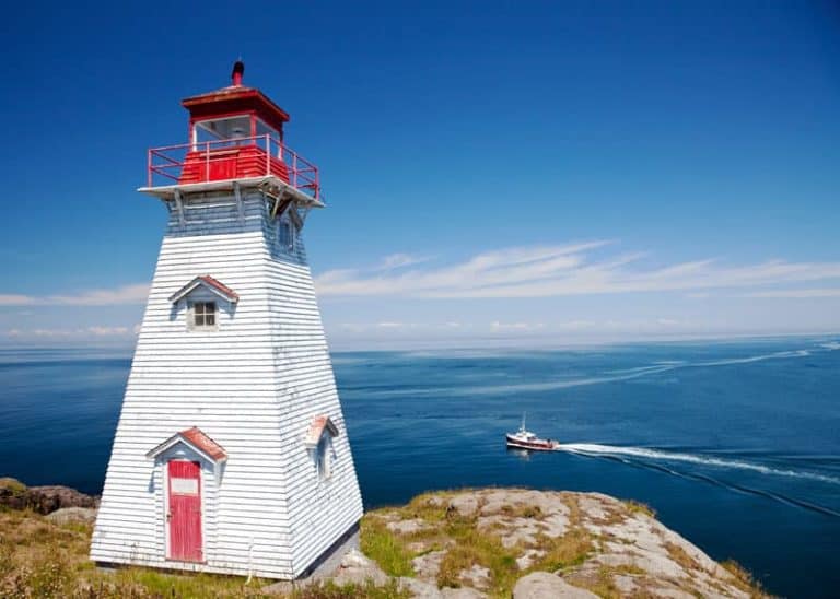
While you road trip around Nova Scotia, why not check out some of these lighthouses?


Hi
You seem to be missing a beach near Crescent and Risser’s Beach along the south shore. Around the bend from Risser’s is Green Bay which has small inlets of beach, making it more private, although you are right along side the road in and out of Green Bay. But my favourite one for sure of those three!
Comprehensive guide with a great list of beaches. Some of these are on my bucket list!
This list is awesome. I have been to about half of them. You must go to Point Michaud beach outside St. Peter’s in Cape Breton! Cold, like all the beaches on the Atlantic side… the ‘Carolina’ temperatures being along the Northumberland Strait… but stunning mike or so of hard packed sand; and most summers they have a surf school and rentals! Enjoying this post!
You are neglecting Beach Meadows Beach, which is another beautiful mile long silver sand beach, just outside of Liverpool. I don’t understand how you could portend to make a definitive list of the “best 41” Nova Scotia Beaches, yet left off some of the truly gorgeous ones. I suggest you re-do the article with more thought put to just how many real beautiful beaches there are in Nova Scotia.
Just wanted to let folks know that currently the beach at Blomidon is “at your own risk” due to high tide damage to the rocks supporting the stairs down to beach.
I love your blog.
Thanks Susan!
You have definitely missed a few beaches on the Northumberland Strait – Brule, Gulf Shore Provincial Park, Dinghy Beach, Heather Beach Provincial Park (lifeguards), Northport Provincial Park, Amherst Shore Provincial Park and Campground, and Tidnish Dock Provincial Park to name a few.
Green Bay beach in Petite Riviere,Conrad beach in Cherry Hill,nice walking beach,limited parking no facilities,Piping Plovers,clam digging,swimming,surfing.
Thanks for the beginning of your great work here. My dream is to travel write about all of these beaches as well as the many yet to be added to this list! After reading the articles as well as the many comments about beaches yet to be explored, my excitement soared! What a beautiful and wonderful place we live in. Personally, I take sanctuary at Lockeport Cresent Beach (which for history lovers was featured on the back of 50 dollar bills) Louis Head Beach (tucked away in Sable River) Summerville Beach, Beach Meadows Beach and so many of the beaches on Cape Sable Island. These beaches all feature silky silver sand and salty breeze that calms the spirit and warms the heart. Lockeport and surrounding area is my home, so, like many others who have commented, we of course know of many beaches not yet added to the list. Some I hope will stay that way for the sake of sanctuary. I appreciate your efforts here and especially the images and directions for future exploration. Never a day without desire for exploring a new Beach!
I guess you’ve never travelled to Cape Sable Island? We have 4 fabulous beaches: Causeway, Stoney Island, South Side and The Hawk beaches would rival many on this list!
We hope to visit there this summer. Thanks for sharing your favourites – we’ll do our best to visit them all!
Obviously you have never been to Guysborough County or your list would include Tor bay Beach, Black Duck Cove Beach, and Port Shoreham Beach; just to name a few.
Why was TorBay beach, eastern shore Nova Scotia not included in this?
I’m a local so I am a little offended. The amount of tourists we get here year round is phenomenal!
I could easily supply photos that would blow people away.
It’s gorgeous here, why are we forgotten?!?!?!
There are many beaches throughout Nova Scotia that could easily have been included in this article. ’41 best beaches’ implies one thing and to be honest and fair the wording should have said ’41 of the best beaches’. In a world where you set yourselves as the experts, omission and exclusion, are inappropriate. Perhaps this can be attributed to a lack of knowledge or research. Though I question the length as well as the earlier observations, the article is beautifully detailed.
Hi David – we are continually updating this article. If you have a beach that you would like to share, please mention it in the comments. We’ll do our best to add it (with full detail) to the list.
Thanks!
Thomas Raddall Provincial Park has some of the nicest beaches in NS.
Carter’s Beach and Summerville my favorite beaches, but totally miss The Hawk and Beach Meadows.
https://youtu.be/US-BFom3Uxg
Sable Island is one great big beach, definatly Nova Scotia’s largest.
People claim West Mabou Beach has N.S.s largest consolidated sand dune system, again Sable Island is the largest hands down.
Mira Gut Beach in Cape Breton; big parking lot, change rooms, Boardwalk, sometimes a canteen, lifeguards, and generally very safe (within the lifeguard flags – strong currents to the right) with awesome sandbars. And if you are a thrill seeker, there is a bridge to jump off!
Thanks Van – I’ll add Mira Gut Beach. I was there as a kid but haven’t been back since. I’ll add this in the next update.
Where is Dominion Beach in Cape Breton? My Mom talks about her summers spent on the ocean as a girl.
Hi Krista – thanks for mentioning Dominion Beach – I’ll add it in the next update.
You totally missed the beautiful beaches of Cape Sable Island…The Hawk, South Side, Stoney Island and the Causeway beach in North East Point.
We’ll be visiting these beaches this summer – and we’ll cover them in full detail. Which one of these is your favourite?
The Hawk is my favourite. Nice hike to The Hawk Point gives a great view of the Cape Sable Lighthouse and on the way you’ll see the Drowned Forest at low tide.
We have got beautiful beaches here on Cape Sable Island. There’s North East Point Beach at the end of the Causeway. Then there’s Clam Point Beach, Stoney Island Beach, South Side Beach and The Hawk Beach. And they are just as beautiful as any of the rest of them..
We’re going to be visiting this summer – can’t wait to cover them all. Thanks for mentioning them!
Some of these beaches are active breeding sites for endangered Piping Plovers, but there are simple way to share the beach with plover families: walk on the wet sand when you’re near sensitive nesting zones marked with signs (plovers nest on dry sand above high tide mark!) and keep pets leashed. Fewer than 50 pairs of Piping Plovers nest in NS, so we need everyone’s help to protect them from disturbance and harm when they’re on our beaches. To learn more, check out http://www.pipingplover.ca. Also, lots more current info on Shelburne County beaches, including access and facilities: https://www.municipalityofshelburne.ca/community/454-2016-beach-brochure/file.html
Thanks for sharing the tips and the links. We’ll cover the Piping Plovers in detail in a future piece. http://www.pipingplover.ca looks like a great resource.
I’ve been to 3/4 of the beaches rated in this article… All are very nice…
Carter’s Beach is on the other side of the trestle and maybe a 15 minute walk from Summerville Beach… The only difference between the two is that Carter’s Beach is remote and isolated and Summerville Beach is 5 times longer… Same sand and same water temp…
In the Cape Breton beaches section, there was no mention of Dominion Beach, Mira Gut Beach or Kennington Cove near Louisbourg… All amazing beaches and very worthy of being a part of this article…
So I give this rater a 3/10, for their oversights and less than adequate research… My wife and I have been to California, different parts of Florida and many Caribbean islands… Aside from the water temp, for me, Summerville Beach (15 minister Southwest if Liverpool…), tops most I’ve been to “anywhere”!!! Sugary white sand stretching close to 2kms, the trestle at the far end where the ocean flows into a river, making the water warmer and the swimming awesome!!! Amazing beach!!’
So for me, Summerville Beach is NS’s best Beach, hands down… Cheers…
Thanks for your suggestions – we’ll be covering all these beaches in a future update. Thanks to feedback and suggestions like yours, we’re going to build the most complete list of NS beaches.
Just an FYI..the beach you refer to as Conrads out Lawrencetown way, is actually Conrods Beach.
Hi Tanya, thanks for letting me know about the other name. I tried to verify which name is correct and it appears that Conrad/Conrod confusion is another example of multiple names for the same place. From what I can tell, the most commonly used name is Conrad’s Beach – NS Tourism, Google, and Trip Advisor all use it. And the road to the beach is named Conrad Road.
I’m happy to add the other name to the beach listing to help people find it. Have you seen the name Conrod’s Beach on signs in the area?
Beach Meadows. Worth a mention in top 41 NS beaches.
Thanks Scott – will definitely check out Beach Meadows this summer.
You also forgot Caribou beach at the provincial park in Pictou. Very long, sandy, warm watered beach. comes with an amazing view of pei and if you time your trip right you can see the ferries crossing the straight ????
Thanks Amanda – we plan to visit Pictou this summer and we’ll be sure to visit (and cover) Caribou Beach.
While you’re in Pictou County you might want to check out Waterside beach as well. My kids and I love it!
Thanks Angela – we’ll definitely check it out.
you forgot Lockeport. there are at least 5 beaches surrounding the beautiful town. the largest beach was once on the 50 dollar bill and there is a tourist centre aswell
Louis Head Beach on the South Shore between Shelburne and Liverpool near Sable River. Not much for facilities however.
Heather’s Beach in Cumberland County is by far my favourite beach in Nova Scotia – includes a beautiful scenic drive!
Missed a few good ones in the Annapolis Valley – Houston’s Beach close to blomidon (locals love it sandy and clam digging), Evangeline Beach in Grand Pre (known for the sandpipers), Black Rock Beach in Black Rock (sea monster street sign). Summerville Beach on the south shore should definitely be on this list, as well as the gorgeous sandy beach at The Hawk on Cape Sable Island, the most southern point in Nova Scotia.
These are some great additions – thanks!
It states there is only one public beach in Mabou but there is also a beautiful beach called Mabou Coal Mines beach .
Thanks Anne!
You forgot Heather Beach in Port Howe NS Cumberland Co on the Northumberland Strait. It’s a supervised beach also !!
Thanks Heather – really appreciate the comment. I’ll check them both out.
You also need to visit the beautiful beaches of Parrsboro and Advocate, and the beaches in between. Also, on the plus side you will be travelling what people call the mini Cabot Trail from Parrsboro to Advocate. It is a beautiful drive with stunning scenery! It is definitely a must see area. I would also like to let you know that the Five Islands Beach you mentioned is in Colchester County, not Hants, and on your way to Parrsboro from there, you will cross the county line into Cumberland County.
Sounds beautiful – we’ll definitely visit that area this summer.
And thanks for the correction about Five Islands Beach – I just fixed that.
Don’t forget Dominion Beach located in Dominion, Cape Breton.
Thanks Paula!
So thrilled that Burntcoat was on the list! It’s an incredible area to see 🙂
You forgot Point Michaud Beach in Cape Breton.
Adding it to the list – thanks Louise!
I see that Point Michaud was mentioned in a comment, so I don’t have to rib you for forgetting the best beach on Cape Breton Island. ???? A tad cold til mid-end July, but beautiful nonetheless. You need to visit it.
Thanks Heather – I’m working on an update and I’ll be sure to add Point Michaud.
It really is one of the best beaches in all of nova Scotia. It has life guards change rooms bathrooms and a picnic park. You can also rent surf boards and in July I think there is people come from all over for a sand castle competition. You can also walk for what feels like miles and it’s all sand. It’s also k ow for having a lot of sand dollars. Also you should look into black brook beach in ingonish it’s beautiful even more so than north bay and ingonish beach. And another one for people who love to surf massive waves is Kennington cove in louisbourg cape breton.
I’m sure every Nova Scotian has their favorites, but you missed both of mine. Summerville as others have mentioned, and Scott’s bay is a great combo of rock hounder’s paradise and endless red sand to walk on at low tide.
Summerville is turning out to be a favourite – it’s the most requested beach (of the ones we missed). We’ll be covering this one soon. Thanks Kristina!
This list is not complete without Summerville Beach in Queens County. Argueably one of the most beautiful beache on the South Shore, and in the province!
Thanks Mena – we’ll definitely add this one. And visit it this summer!
Summerville is by far one of the best beaches on the south shore!!! Gorgeous white sand, water at times warm, lots of facilities and relatively quiet never overpopulated
Google maps is correct for the highways in Port Mouton to Carters Beach. A bypass went in last fall. The old Hwy 103 is now Hwy 3!
Love the videos of all the places!
Thanks for the update Alecia – Google must have updated the map in anticipation of the new bypass. I’ll update the guide.
I live near the beautiful Provincial Park Summerville Centre 1mile long white Beach which as picnic tables, washrooms and change houses. Lots of room for parking as well. The ocean water may be a bit cold in the early summer but the river water running down on the end of the beach is very nice for swimming.
We are located 10 km from Liverpool on Hwy. 3 … Our Exits are 20A coming from Halifax and Exit 21 coming from Yarmouth.
Thanks so much Alice – sounds very nice. Can’t wait to visit and write about it!
The eastern shore extends well beyond Halifax County. The author obviously never traveled into Guysborough County and experienced two beautiful beaches in Tor Bay and New Harbour. These are off the beaten track along the Marine Drive where you’ll experience rugged scenery and stunning seascapes.
Hey Kevin – thanks for your comment. You’re right, I haven’t been to either Torbay or New Harbour beaches. But they’re on my list – they sound amazing.
I agree Guysborough County has beautiful Beaches..Tor bay New Harbour are both gorgeous!!
Missed Frieda’s Beach in Chester (ok, it isn’t all that great)…..we prefer the private beach at my sister and brother-in-law’s on the peninsula…..you missed a few others on the South Shore but I think I will not go into details so we locals can keep some places to ourselves….
Thanks Teri! On this guide, we’ll just include beaches with services that appeal to the masses. In the future, we’ll probably write about unserviced beaches that are off the beaten path.
No such list can be entirely comprehensive of course, but how a list could include White Point and Keji Seaside, but miss Summerville, a beautiful mile-long white sand beach with a provincial park, is puzzling.
Thanks Margaret – we’ll definitely add Summerville Beach. This list is a starting point and it will be continually updated.
Any recommendations are welcome.
Bryan
Yes, I would say that Summerville is by far one of the best beaches. Thank you for the list though as there are many I have not been to.
I was just thinking the same thing. How could they forget Summerville beach? Or even Hunts Point beach?
You folks deffinetly forgot a few of beautiful beaches .. views …. better make a trip to PUGWASH NOVA SCOTIA !!!
You’re right. We don’t know that area well – it’s on our list for this summer.
What beach(es) do you recommend?